  |
|
|
All pictures posted here were taken by us. Those from Google, brochure, and the web were duly noted. Most of my posted photos are still missing captions because I do not have time for them yet.
Note: Day 1 was flying from PDX (Portland, Oregon) to JFK (Kennedy Airport in New York), then to LHR (London), while Day 13 was flying home from Paris. |
������ժ������:
���з����������Ƭ��������ҳժȡ�Ķ����������������Ķ��������Լ��ĵġ���������Ƭû�м�ע�ͣ���Ϊ����û��ʱ���֤���ϡ�
ע����һ��ϵ��������Ӣ������ʮ����ӷ����ɻ������� |
| by
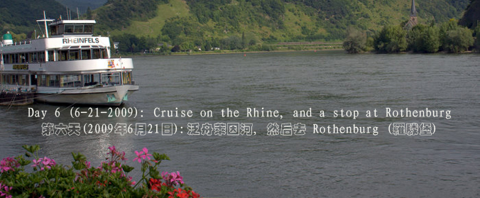
the River Rhine ������� |
||
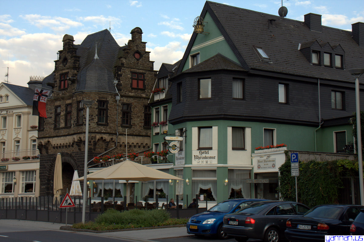
The hotel
we stayed by the bank of River Rhine�� Zum Anker. It's family operated,
but is clean, tidy and friendly, like all German we met. It is
also the only hotel in all of our European tour that I could get a free
wireless access to the Internet. All other European hotels
charge the Internet access by the minute--as if their livelihood depends
on it. |
 |
����������ϵ�һ���¹��������ǵ�����ס��������硣�����Ǽ��徭Ӫ��С�ɣ������࣬���ʣ���ͬ���������ĵ¹��ˡ���Ҳ������ŷ������Ψһ��������������������硣���������磬����ȫ����������Ǯ���������ǵ����ƾ�ָ������ |
 |
||
 |
||
 |
||
 |
||
 |
���������� | |
 |
||
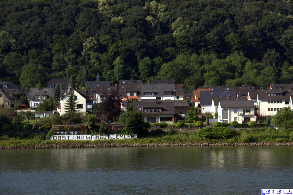
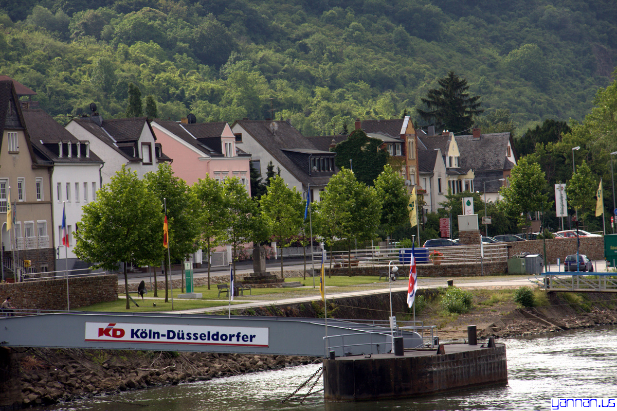
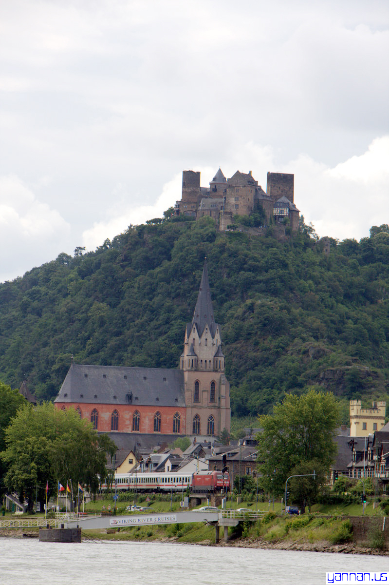
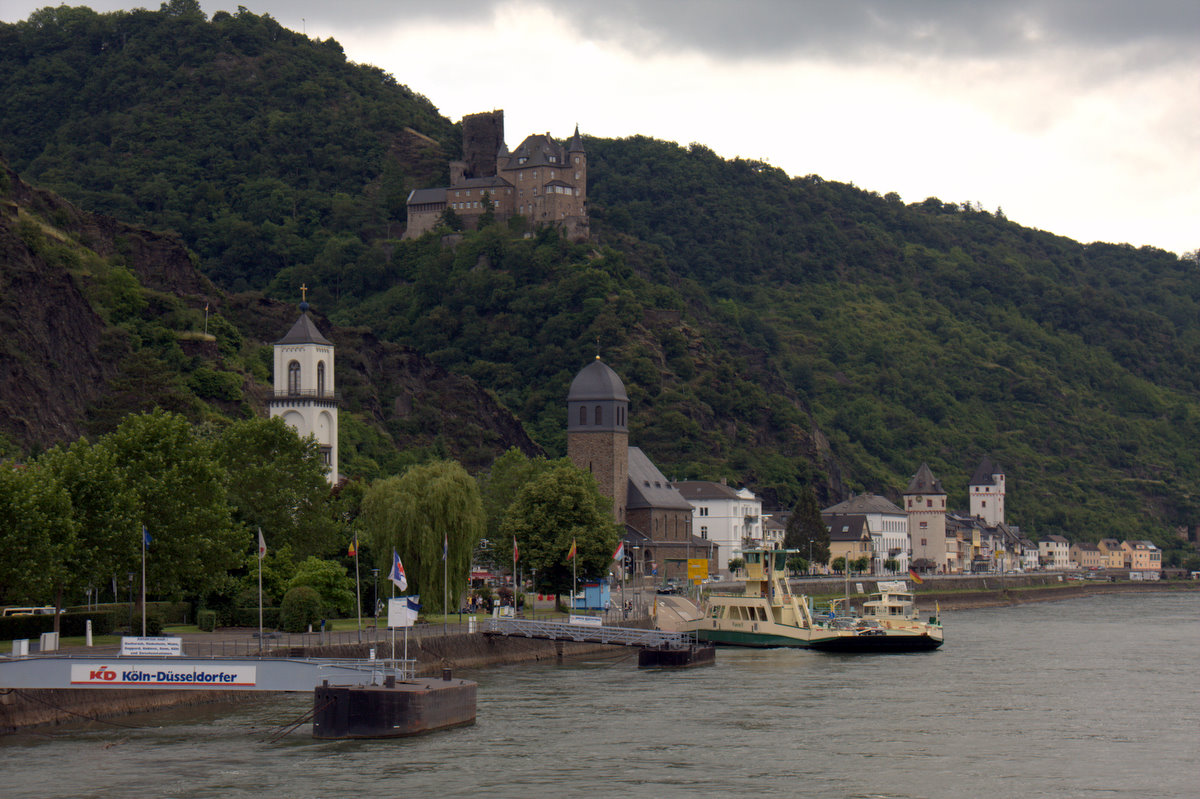
towns, villages, castles and fortifications along the Rhine Below from Wikepedia: The Rhine is one of the longest and most important rivers in Europe, at 1,320 km (820 mi), with an average discharge of more than 2,000 m3/s (71,000 cu ft/s). The Rhine and the Danube formed most of the northern inland frontier of the Roman Empire and, since those days, the Rhine has been a vital, navigable waterway, and carried trade and goods deep inland. It has also served as a defensive feature and has been the basis for regional and international borders. The many castles and prehistoric fortifications along the Rhine testify to its importance as a waterway. River traffic could be stopped at these locations, usually for the purpose of collecting tolls, by the state that controlled that portion of the river. |
 |
������ϵ�����ׯ��ű� ������ժ��ά���ٿ����R��ӰlԴ���ʿ���Ͱ���ݵİ�����˹ɽ����;����֧��ʿ�ǡ��µ��������ͷ������ں��m���뱱����ȫ�LԼ1320���ͨ����883����������Լ20��ƽ������[1]������ӵij�����ŷ���������ģ������ڷ����Ӻӡ���觺���������ӣ���ͬʱҲ���������æ��ˮ��֮һ�� |
 |
||
 |
||
 |
||
 |
||
 |
||
In very village,
there is a church.
|
 |
ÿ����ׯ����һ���ⶥ���� |
 |
||
 |
||
| a
stop at Rothenburg ������
|
||
|
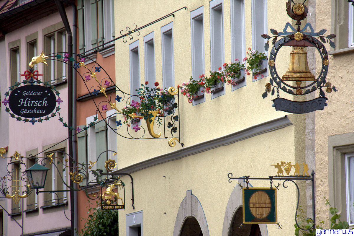
A famous street in Rothenburg with Koboldzellersteig and Spitalgasse Below is from Wikipedia: Rothenburg ob der Tauber is a town in the district of Ansbach of Mittelfranken (Middle Franconia), the Franconia region of Bavaria, Germany, well known for its well-preserved medieval old town, a destination for tourists from around the world. In the Middle Ages, it was an Imperial Free City. A significant fraction of Rothenburg is carfree. |
 |
�¹��ų������� ������ժ������: ������ (�ղ���) ����������ʷ�ƾõ�ó�ųǣ�ʮ������������ʥ�����۹������ɳǰӵ�ж����ķ�����˾��Ȩ��������ó����١���ΰ�ij�ǽ�ͼ�̵ij����������ͳ��е������������������������յij�ǽ������ǽ��Χ�Ľֵ�Ҳ��������ԭò���ڹųǵ�ʯ·��ɢ�����ʵǹ��ϵij�ǽ�����Ը��������͵�����������һ��Ȥζ�� |
 |
||
 |
||
| It
was a surprise as well as a pleasure to find a Chinese restaurants in
such a prime real estate. The signs (top left) usually are an
indication of what Chinese cities the owners came from, and what cuisine
to expect. |
 |
�������������ĵضο����вݣ��������и��ˡ�����(���Ϸ�) һ����Ը������ʦ�����й���������ʲô�ˡ� |
The iron bars on the grass
by the road appear to have one purpose: stopping cars from driving over
or parking on them. |
 |
·�߲ݵ��ϵ�������Ӧ����������ֹ����ͣ����ȥ�ġ� |
|
street posters and ads |
 |
��ͷ��� |
 |
||
(Click image to enlarge. ����ͼƬ���ɷŴ�
![]() Day
7 (6-22-2009): Passing Austria
from Munich, then a stop
at Cortina
Day
7 (6-22-2009): Passing Austria
from Munich, then a stop
at Cortina
![]() ������(2009��6��22��):�뿪�¹�Ľ��������µ������������
Cortina (�ƶ����ɵ�������1956�궬������ƥ���˶�������)
������(2009��6��22��):�뿪�¹�Ľ��������µ������������
Cortina (�ƶ����ɵ�������1956�궬������ƥ���˶�������)
|
|


